
Ditch / Field notes
Jobsite GPS Photo Metadata: View, Add, and Remove in 2 Minutes
Jobsite GPS Photo Metadata: View, Add, and Remove in 2 Minutes
Most photos shot on a phone or GPS-enabled camera already carry location coordinates buried in the file. You can read them in seconds with a browser EXIF viewer or a tool like ExifTool. If a photo has no GPS photo metadata, you can add it manually by dropping a pin on a map or by matching timestamps to a GPX track. Before you share anything publicly, check for hidden location fields and strip them if privacy matters.
TL;DR:
- Most photos already contain GPS coordinates in their metadata, which can be quickly read using browser tools, OS properties, or ExifTool.
- Adding or correcting GPS data involves manual pin placement for individual images or batch geotagging using GPX track files synced to timestamps.
- GPS location data is stored mainly in EXIF GPS directories, sidecar XMP files, or embedded within HEIC containers, requiring specific tools to access or clear.
- Removing GPS metadata before sharing involves using tools like ExifTool to erase GPS tags and verifying their removal, especially from sidecars and hidden data blocks.
- GPS coordinates can be inaccurate due to clock drift or urban signal interference, which can often be fixed by checking timestamps and manually adjusting data.
Table of Contents
- What Is GPS Photo Metadata and How Do You View It?
- How Do You Add or Edit GPS Metadata on a Photo?
- Where Does GPS Data Actually Hide in a Photo File?
- How Do You Remove GPS Metadata Before Sharing Photos?
- Why Do GPS Coordinates on Photos Sometimes Look Wrong?
- Why GPS Tagging Matters More on a Jobsite Than in a Photo Album
- A Faster Way to Handle GPS Tagging on Every Jobsite Photo
- Sources
- FAQ
What Is GPS Photo Metadata and How Do You View It?
GPS photo metadata is the location data a camera or phone writes directly into a photo file, following the EXIF standard’s GPS tag structure. Getting it out is usually a two-minute job, and you have three practical routes depending on how deep you need to go.
The fastest option is a browser-based EXIF viewer. Drop the photo into a tool like BulkPicTools’ EXIF viewer, and it reads the GPS tags and often plots the point on a map, all without uploading the file to a server. That local processing matters if the photo is sensitive.
Your operating system can also do a quick check without installing anything:
- Windows: right-click the photo, choose Properties, then open the Details tab and scroll to the GPS section.
- macOS: open the file in Preview, hit Command+I for the Info panel, or swipe up on a photo in the Photos app to reveal its map location.
- Mobile: most gallery apps show a location tag directly under the photo if one exists.
For real control, use ExifTool, the command-line utility built specifically for reading and writing metadata tag by tag. A command like exiftool -gps:all photo.jpg pulls every GPS field: GPSLatitude, GPSLongitude, GPSAltitude, and GPSImgDirection if the camera recorded a compass heading. ExifTool typically reports coordinates in degrees, minutes, seconds (DMS) format, which you can convert to decimal degrees for pasting into Google Maps. Some tools also let you export the results as a GPX file for reuse in mapping software.
How Do You Add or Edit GPS Metadata on a Photo?
Adding location data works differently depending on whether you’re fixing one photo or geotagging an entire folder from a shoot.
For a single image, a web-based pin editor is the simplest path. Tools like FreeGeoTagger let you search an address or drop a pin directly on a map, then download the photo with the coordinates written into its EXIF fields, often with no server upload involved.
For batches, the standard method is a GPX time-sync workflow:
- Record a GPS track during your shoot using a phone app or dedicated GPS logger.
- Confirm your camera’s clock offset against real time (more on that below).
- Run a matching tool, such as KGeoTag, that pairs each photo’s timestamp with the nearest GPX point.
- Write the resulting coordinates either into XMP sidecar files or directly into the image.
If you prefer full manual control, ExifTool writes GPS tags directly:
exiftool -GPSLatitude=40.7484 -GPSLatitudeRef=N -GPSLongitude=-73.9857 -GPSLongitudeRef=W photo.jpg
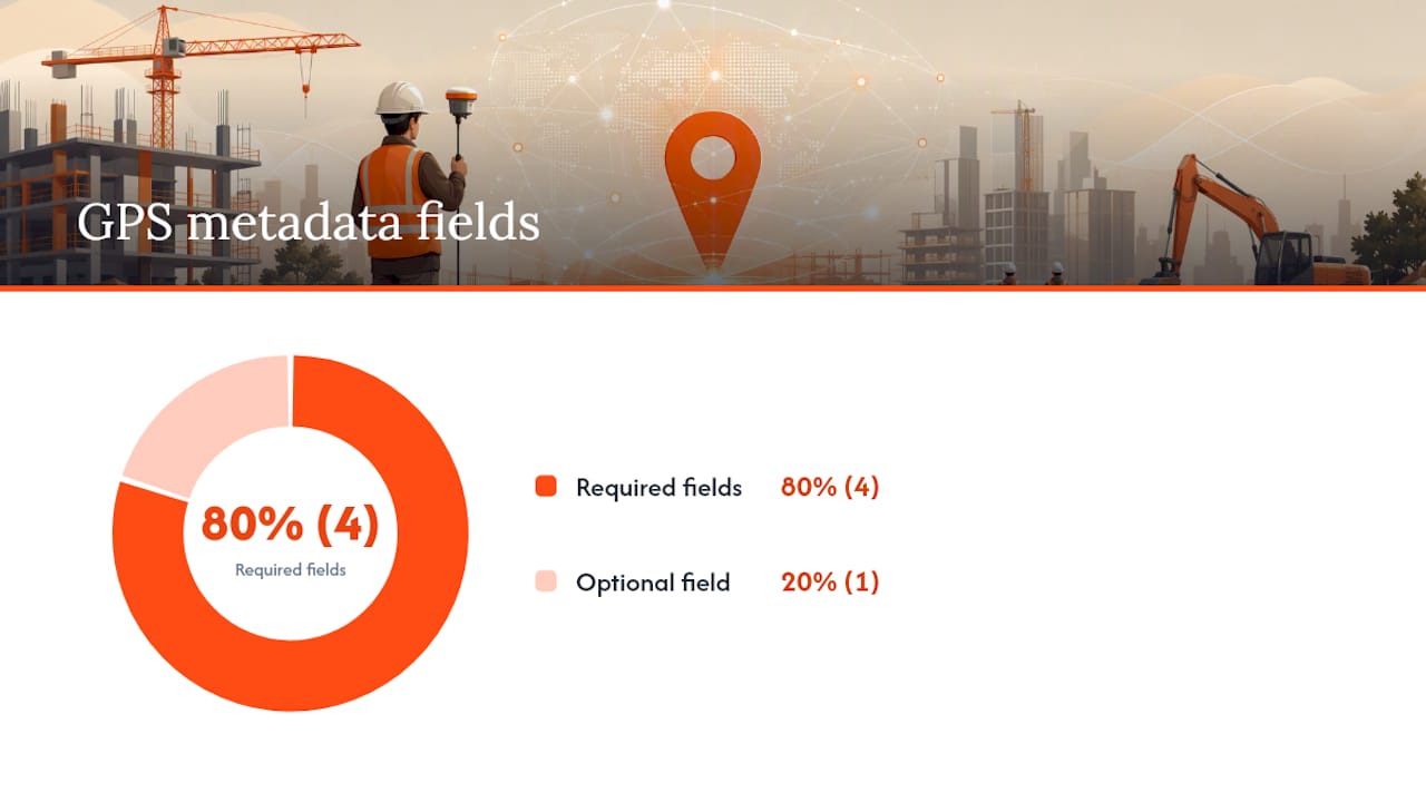
You need all four fields (GPSLatitudeRef, GPSLatitude, GPSLongitudeRef, GPSLongitude) for the coordinates to register correctly, and GPSAltitude if elevation matters for your use case.
Pro Tip: Run any batch edit on a copy first. Skip -overwrite_original_in_place until you’ve confirmed the coordinates landed correctly on a few test files.
RAW shooters should know that RAW formats generally take GPS data through an XMP sidecar rather than embedding it directly, since writing to the sidecar first keeps the original RAW file untouched. HEIC files can be trickier: not every version of ExifTool handles Apple’s HEIC container the same way, so test a single file before running a batch.
Where Does GPS Data Actually Hide in a Photo File?
Location data doesn’t always live where you’d expect, and that’s exactly why some “cleaned” photos still leak coordinates.
- EXIF GPS IFD: The official EXIF standard stores location inside a dedicated GPS Image File Directory, with tags like GPSLatitude, GPSLongitude, GPSAltitude, and GPSTimeStamp.
- XMP sidecars: RAW workflows and some editing software store location in a separate
.xmpfile next to the image, which means stripping the photo itself doesn’t touch the sidecar. - HEIC/HEIF containers: Apple’s format can store metadata in blocks that some generic metadata cleaners don’t recognize, so a tool built for JPEG may miss it entirely.
- Edited exports and screenshots: Editing apps and screenshot tools sometimes strip GPS data automatically during export, and sometimes silently preserve it. Always re-check after exporting, never assume.
How Do You Remove GPS Metadata Before Sharing Photos?
A single uploaded photo with intact GPS metadata can point directly to someone’s front door. Real estate photos, photos of kids at a regular after-school location, or images from a private residence have all been used to pinpoint addresses that the poster never meant to share, which is part of why privacy researchers flag geotagging as a real exposure risk.
Scrubbing is quick once you know where to look:
- Run a photo through an in-browser EXIF remover before posting it anywhere public.
- Use your OS export settings. Many “share” or “export for web” options offer a metadata-stripping checkbox.
- With ExifTool,
exiftool -gps:all= photo.jpgdeletes just the GPS block; add-xmp:all=if you also need to clear the XMP sidecar data.
Always verify the scrub worked. Reopen the file in an EXIF viewer and check both the EXIF and XMP sections; a tool that only checks EXIF can miss location data sitting in the XMP block. Note that social platforms vary widely in how they handle this: some strip metadata automatically on upload, but direct file transfers, email attachments, and cloud shares generally preserve everything.
Pro Tip: If the photo is sensitive, scrub the timestamp along with GPS data, and keep the original file archived somewhere secure rather than deleting your only unedited copy.
Why Do GPS Coordinates on Photos Sometimes Look Wrong?
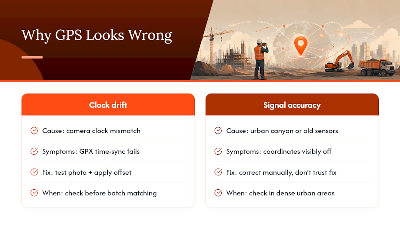
Bad GPS matches usually come down to one of two things: clock drift or signal accuracy, and both are fixable once you know what to check.
Clock drift happens when your camera’s internal clock doesn’t match real time, which throws off any GPX time-sync match. The fix is simple: take a test photo at a known location and time, then compare the camera’s recorded timestamp against your phone’s clock at that same moment. The difference is your offset, and most geotagging tools let you apply that offset before matching the rest of the batch.
Accuracy limits are separate from drift. Dense urban areas cause “urban canyon” effects where GPS signals bounce off buildings before reaching the device, and older phone hardware simply logs less precise fixes than newer sensors. When coordinates look obviously off, correct them manually rather than trusting the raw fix.
Treat GPS metadata as one piece of evidence, not the whole case. Forensic researchers note that GPS fixes can be imprecise or altered, so for journalism, legal claims, or insurance disputes, metadata should corroborate other evidence rather than stand alone.
For large batches, run a preview or dry-run pass first so you can see intended changes before anything gets written, keep your XMP sidecars as the first write target, and only embed coordinates into the final files once you’ve confirmed the matches are correct.
Why GPS Tagging Matters More on a Jobsite Than in a Photo Album
Precise location data on jobsite photos does something a vacation photo’s GPS tag never has to: it settles arguments. When a subcontractor disputes what was installed where, or an inspector needs to confirm which unit a photo shows, accurate GPS metadata turns a “he said, she said” into a five-second lookup.
Manually checking and tagging hundreds of jobsite photos a week isn’t realistic for most crews, which is exactly the gap automated tagging closes. Pairing GPS capture with AI-driven organization means every photo becomes searchable by location without anyone touching a metadata field by hand.
None of this replaces good judgment on permissions and backups. Location data on active jobsites can be sensitive too, so keep records access controlled and back up your originals before any bulk edit.
— Will
A Faster Way to Handle GPS Tagging on Every Jobsite Photo
Manually checking EXIF fields works fine for one photo. It falls apart fast once you’re managing hundreds of jobsite images a week across multiple sites. Ditch was built to close that gap: it automatically tags every photo with GPS location, along with equipment and work type, so you never have to run ExifTool by hand to find out where a shot was taken.
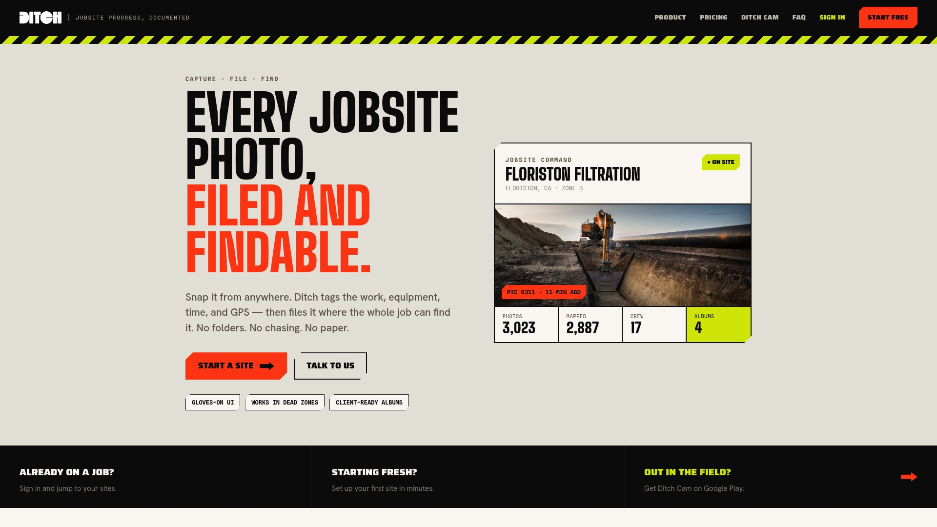
Instead of digging through a camera roll or running batch commands to confirm a location, Ditch groups your photos by location and time automatically, then lets you search by GPS, equipment, or job type in seconds. Pricing is based on jobsites rather than headcount, so adding your whole crew doesn’t add per-user costs, and a free plan is available for teams working a single jobsite. Check out Ditch’s full feature set or compare pricing tiers to see which plan fits your project load.
Sources
For hands-on verification, ExifTool’s GPS tag documentation covers exact field names for reading and writing. FreeGeoTagger handles manual pin-based tagging, and KGeoTag documents the GPX time-sync process for bulk work.
FAQ
How do I get GPS metadata from a photo?
Open the file in a browser EXIF viewer, check your OS file properties panel, or run exiftool -gps:all photo.jpg from the command line for the complete tag set.
How can I find the GPS location of a photo?
Extract the GPSLatitude and GPSLongitude values with an EXIF viewer or ExifTool, then paste those decimal or DMS coordinates into any map application to see the exact point.
Can you get a GPS location from a picture that has no metadata?
Not directly. If EXIF and XMP fields are empty or were stripped, you’d need to add coordinates yourself using a manual pin editor or by matching the photo’s timestamp to a GPX track.
What does “EXIF GPS” mean in a photo?
It refers to the GPS Image File Directory inside a photo’s EXIF data, the standard location where a camera or phone stores latitude, longitude, altitude, and related fields.
Can Ditch tag GPS locations on jobsite photos automatically?
Yes. Ditch reads and tags jobsite photos with GPS location automatically, grouping them by site and time so crews can search records without manually checking metadata.